


© 2009 UnParalleled, LLC.
All rights reserved.
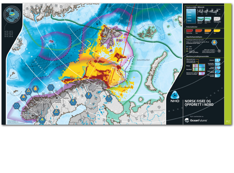
Norway’s Northern Seas
Oslo, Norway
UP was engaged by Ocean Futures of Norway to design 8 maps containing multiple types of
data per map to show their impacts upon each other. Data included: fisheries production/intensity,
maritime boundaries, oil & gas exploration, power generation, natural resources and much more.
Environmental Research and Assessment of Cambridge, England provided all GIS
projections, data filtering and components for this multi-national project.
This series of maps won the coveted British Cartographic Society Award.